
Page 153 - Çevre Şehir İklim İngilizce - Sayı 4
P. 153
Orhan İNCE - H. Abdullah UÇAN et al.
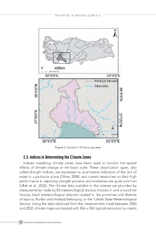
Figure 2. Location of the study area
2.3. Indices in Determining the Climate Zones
Indices classifying climate zones have been used to monitor the spatial
effects of climate change at the basin scale. These classification types, also
called drought indices, are expressed as quantitative indicators of the lack of
water in a particular place (Oliver, 2008), and current researches on their high
performance in depicting drought patterns and intensities are quite common
(Ullah et al., 2022). The climate data available in the indexes are provided by
measurements made by 83 meteorological stations located in and around the
Antalya basin (meteorological stations located in the provinces and districts
of Isparta, Burdur and Antalya) belonging to the Turkish State Meteorological
Service. Using the data obtained from the measurement made between 2000
and 2022, climate maps are created with 30m x 30m spatial resolution by means
142 The Journal of Environment, Urban and Climate