
Page 151 - Çevre Şehir İklim İngilizce - Sayı 4
P. 151
Orhan İNCE - H. Abdullah UÇAN et al.
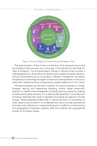
Figure 1. Planning Stages for Climate Change (UN Habitat, 2014)
The spatial pattern of the climate and the level of its temporal impact and
the change process are seen as a critical gap in the decisions to be made for
cities and regions. The temporal-spatial change in climate zones provides a
useful perspective in the production of planning strategies for spatial decision-
making. Spatial planning can be guiding in disaster management processes,
transportation and energy strategies and sectoral developments on the macro
scale; and in design decisions, energy saving, material selection on micro scale.
Climate parameters are the basic inventory for analyzing temporal change.
However, reading and interpreting changing climatic values temporally-
spatially is a need for the management of rapidly growing, spreading, leaping
and developing urban patterns. It is a useful guide especially in countries, such
as Türkiye, where the risk is high on disasters that are/are not related to climate
change. Temporal-spatial studies help to reduce the level of vulnerability of
cities, regions and countries in a multidimensional way in a social, physical and
economic terms. Moreover, in today’s technological conditions, remote sensing
and geographical information systems (GIS) also facilitate the geographical
analysis of non-spatial values.
140 The Journal of Environment, Urban and Climate