
Page 170 - Çevre Şehir ve İklim Dergisi İngilizce - Özel Sayı
P. 170
Determination of Potential Avalanche Release Areas, Avalanche Mobile Application and
Preparation of Avalanche Hazard Maps in Türkiye; the Case of Palandöken Ski Centre
Ski Resort, to accurately detect areas of potential hazard and thus, to render
the avalanche hazard and risk management in the area more efficient. The
unique value of this study lies in its comprehensive analysis that combines both
field data and avalanche simulations for the detection of avalanche hazards,
making it more comprehensive than other studies in the literature. It aims to
provide a methodological foundation for creating avalanche hazard maps in
Türkiye, establishing a standard for similar future studies. The results obtained
will contribute to the development of avalanche hazard and risk management
policies at the national level and to the better planning of administrative and
technical measures to be taken in areas under avalanche threat. This study, along
with the aforementioned past similar studies, will serve as a guide for establishing
construction standards for avalanche hazard maps in Türkiye in the future.
2. Material and Method
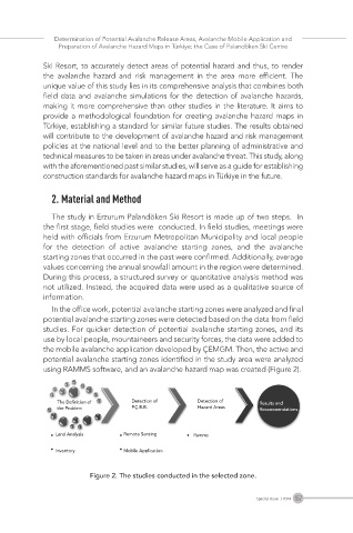
The study in Erzurum Palandöken Ski Resort is made up of two steps. In
the first stage, field studies were conducted. In field studies, meetings were
held with officials from Erzurum Metropolitan Municipality and local people
for the detection of active avalanche starting zones, and the avalanche
starting zones that occurred in the past were confirmed. Additionally, average
values concerning the annual snowfall amount in the region were determined.
During this process, a structured survey or quantitative analysis method was
not utilized. Instead, the acquired data were used as a qualitative source of
information.
In the office work, potential avalanche starting zones were analyzed and final
potential avalanche starting zones were detected based on the data from field
studies. For quicker detection of potential avalanche starting zones, and its
use by local people, mountaineers and security forces, the data were added to
the mobile avalanche application developed by ÇEMGM. Then, the active and
potential avalanche starting zones identified in the study area were analyzed
using RAMMS software, and an avalanche hazard map was created (Figure 2).
Figure 2. The studies conducted in the selected zone.
157
Special Issue / 2024