
Page 140 - Çevre Şehir ve İklim Dergisi İngilizce - Özel Sayı
P. 140
National Scale Land Cover Classification and Monitoring System
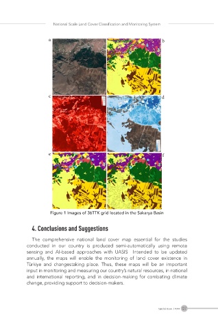
Figure 1 Images of 36TTK grid located in the Sakarya Basin
4. Conclusions and Suggestions
The comprehensive national land cover map essential for the studies
conducted in our country is produced semi-automatically using remote
sensing and AI-based approaches with UASIS Intended to be updated
annually, the maps will enable the monitoring of land cover existence in
Türkiye and changestaking place. Thus, these maps will be an important
input in monitoring and measuring our country’s natural resources, in national
and international reporting, and in decision-making for combating climate
change, providing support to decision-makers.
127
Special Issue / 2024