
Page 123 - Çevre Şehir İklim İngilizce - Sayı 1
P. 123
Yasemin Şentürk - Kemal Mert Çubukçu
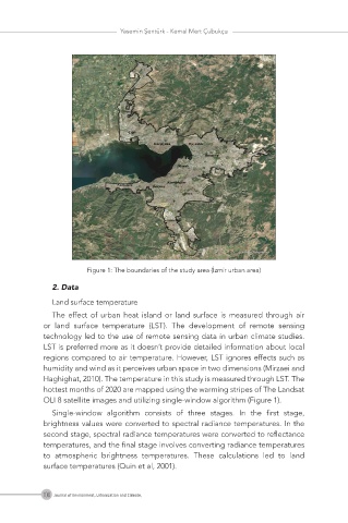
Figure 1: The boundaries of the study area (İzmir urban area)
2. Data
Land surface temperature
The effect of urban heat island or land surface is measured through air
or land surface temperature (LST). The development of remote sensing
technology led to the use of remote sensing data in urban climate studies.
LST is preferred more as it doesn’t provide detailed information about local
regions compared to air temperature. However, LST ignores effects such as
humidity and wind as it perceives urban space in two dimensions (Mirzaei and
Haghighat, 2010). The temperature in this study is measured through LST. The
hottest months of 2020 are mapped using the warming stripes of The Landsat
OLI 8 satellite images and utilizing single-window algorithm (Figure 1).
Single-window algorithm consists of three stages. In the first stage,
brightness values were converted to spectral radiance temperatures. In the
second stage, spectral radiance temperatures were converted to reflectance
temperatures, and the final stage involves converting radiance temperatures
to atmospheric brightness temperatures. These calculations led to land
surface temperatures (Quin et al, 2001).
108 Journal of Environment, Urbanization and Climate,